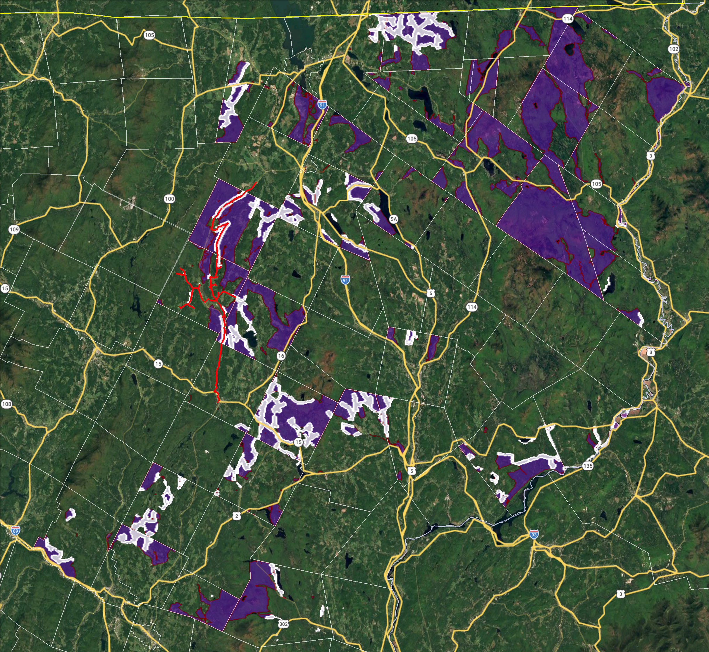
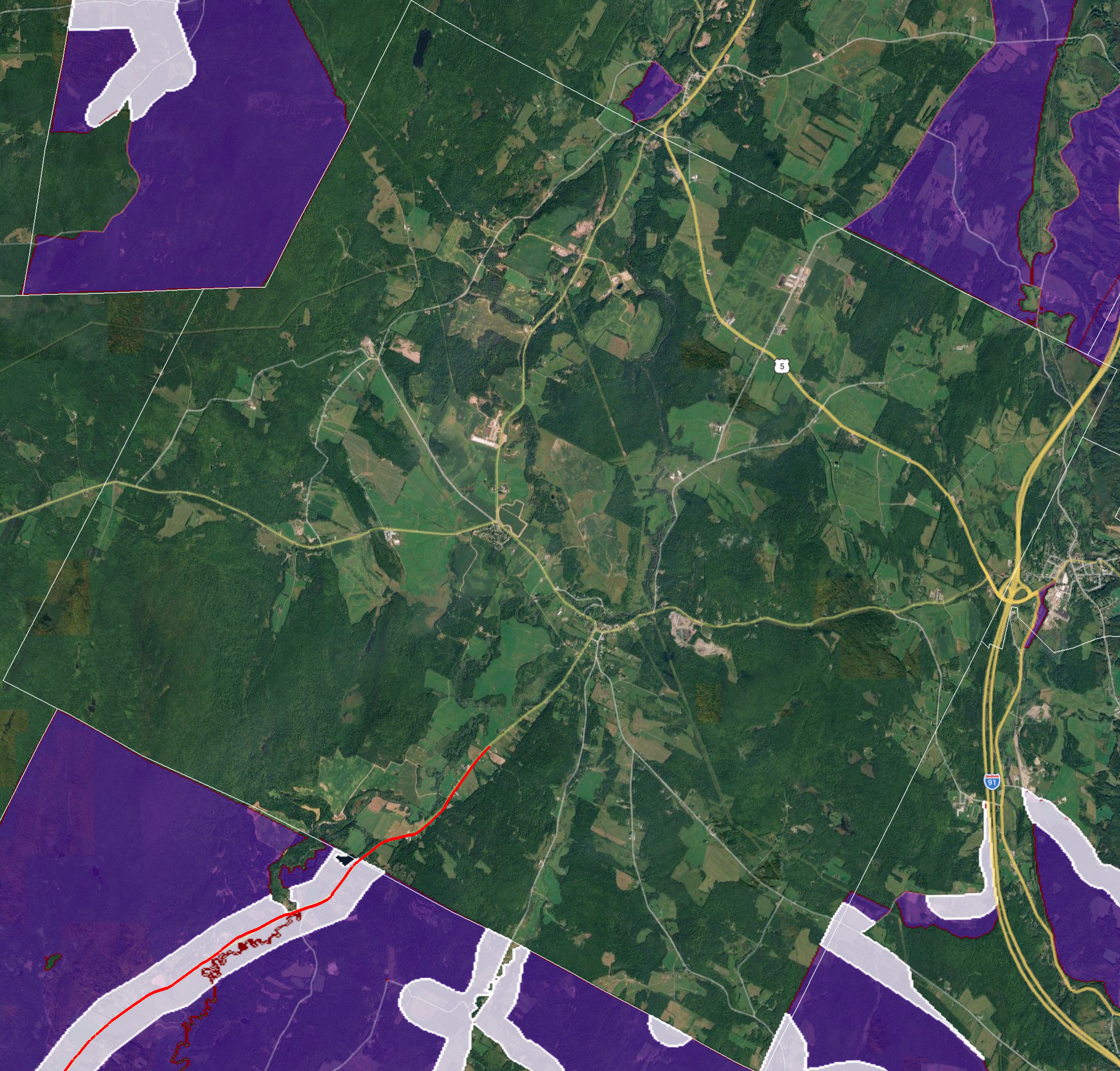
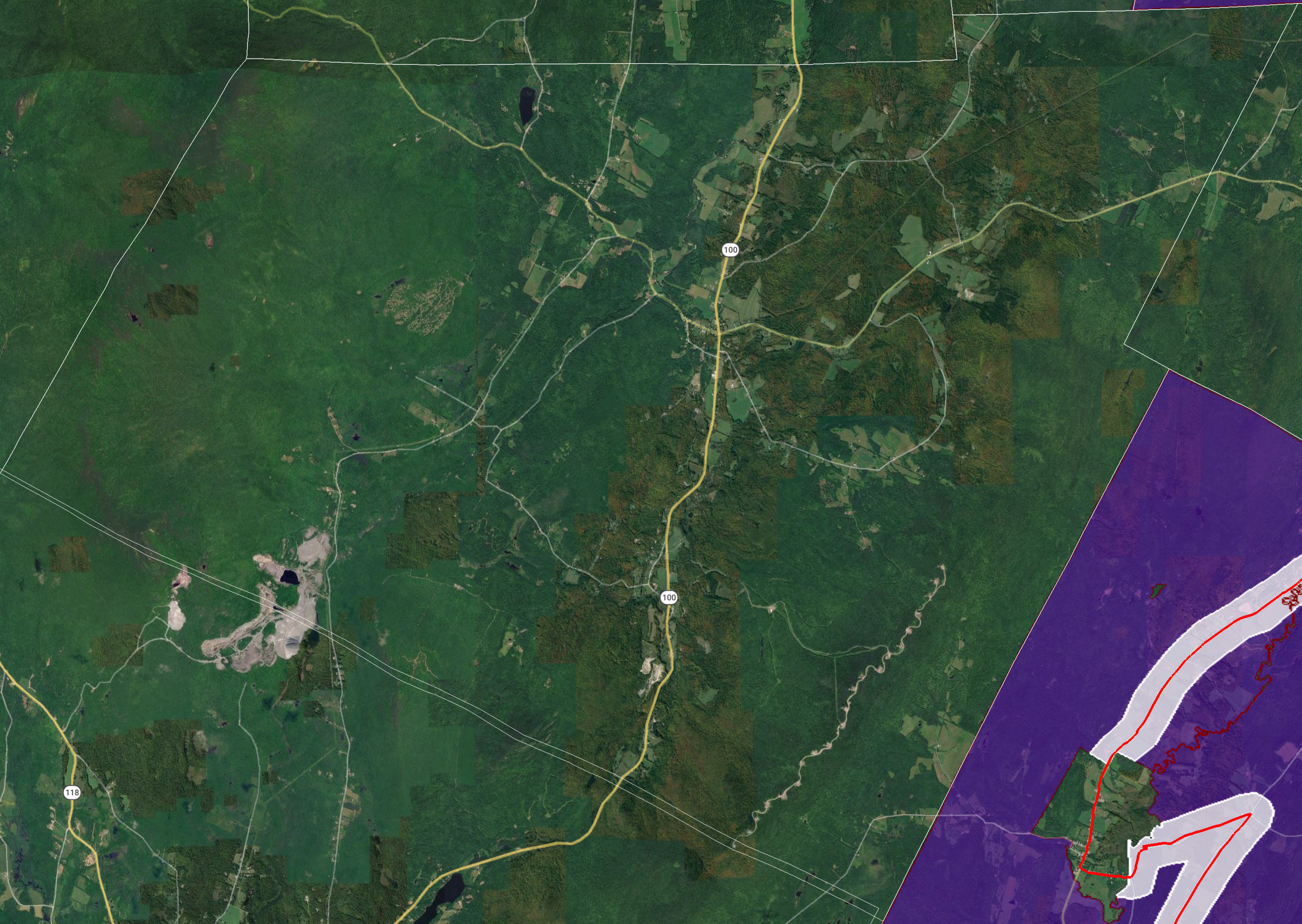
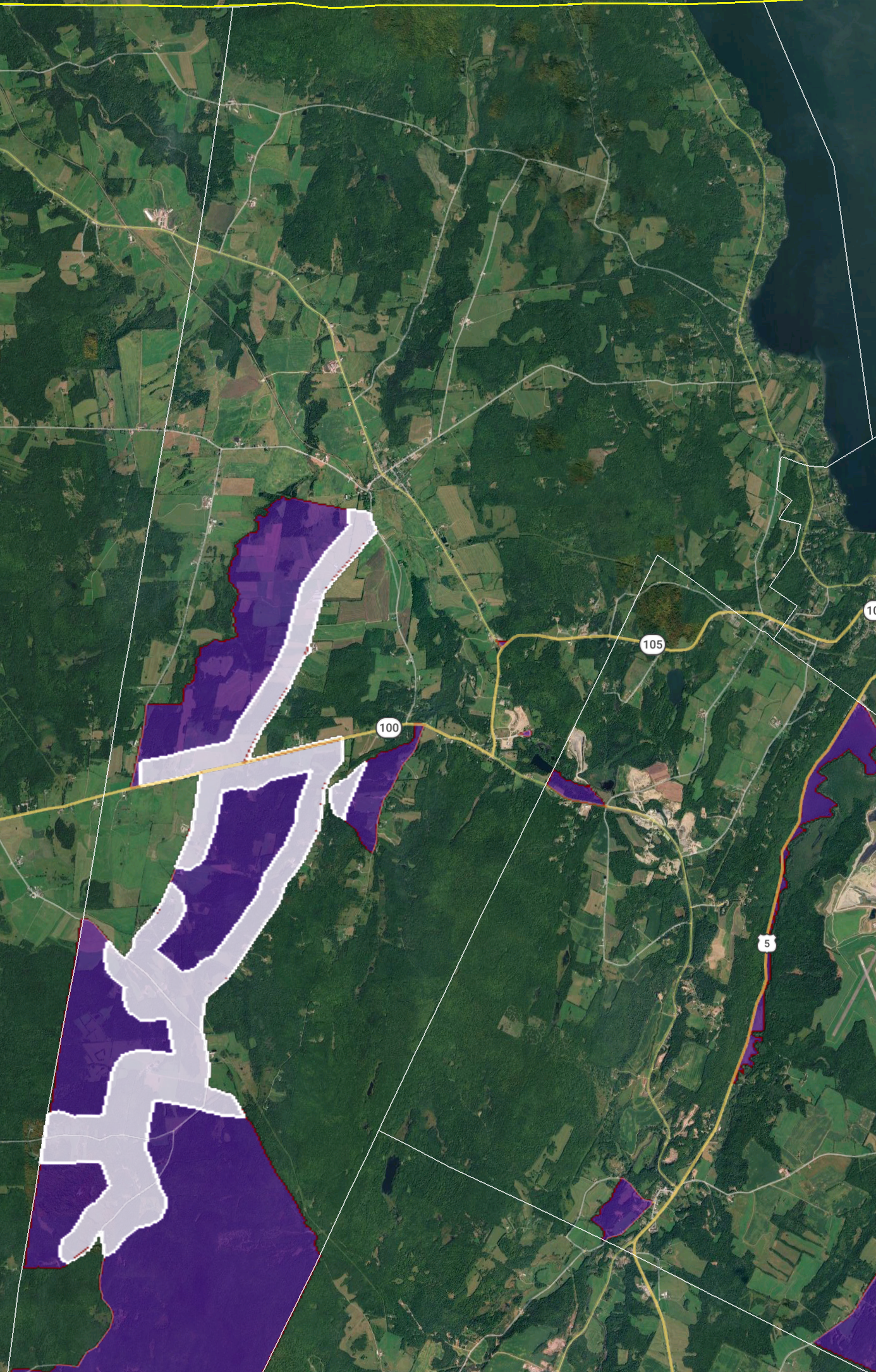
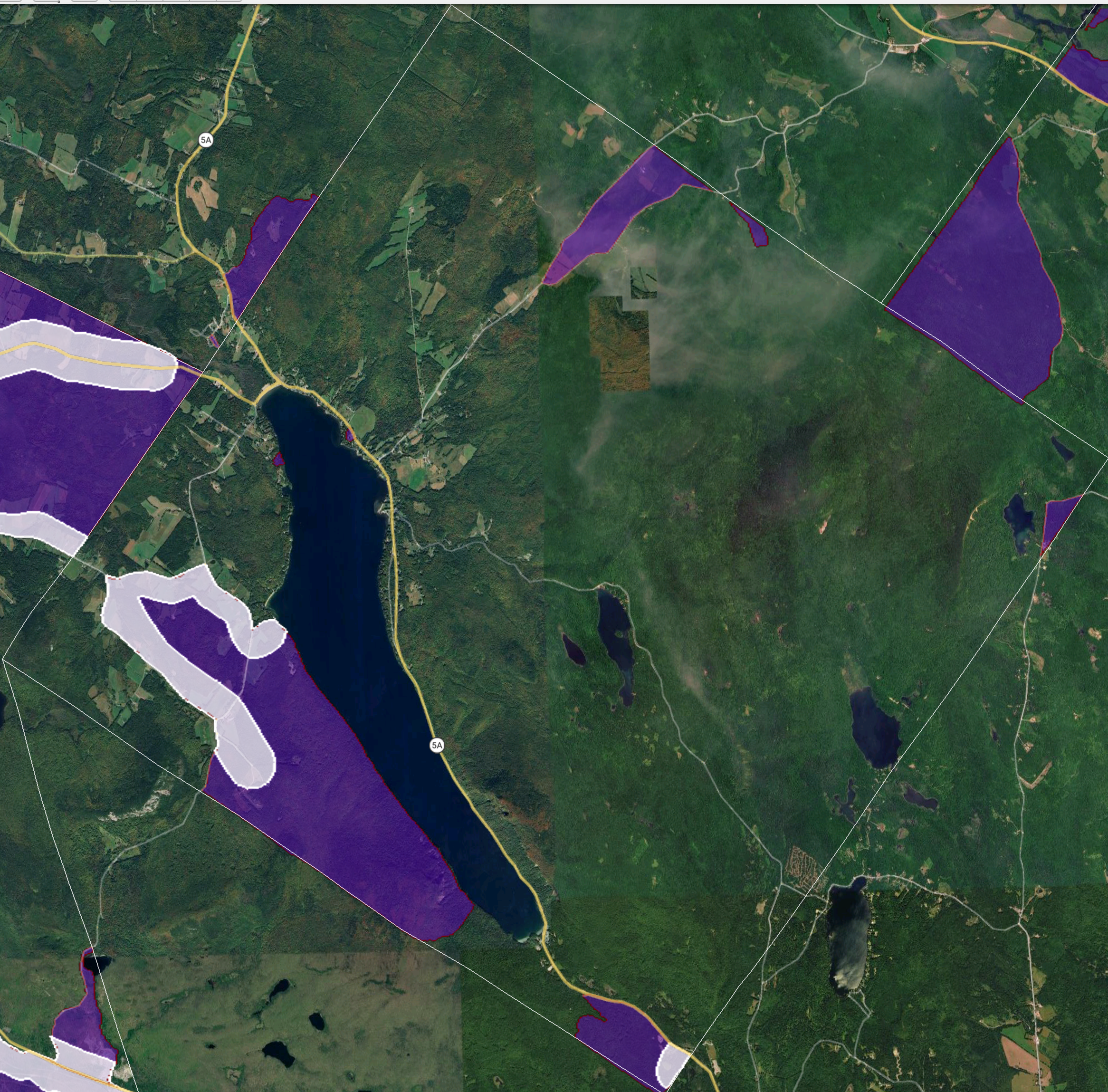
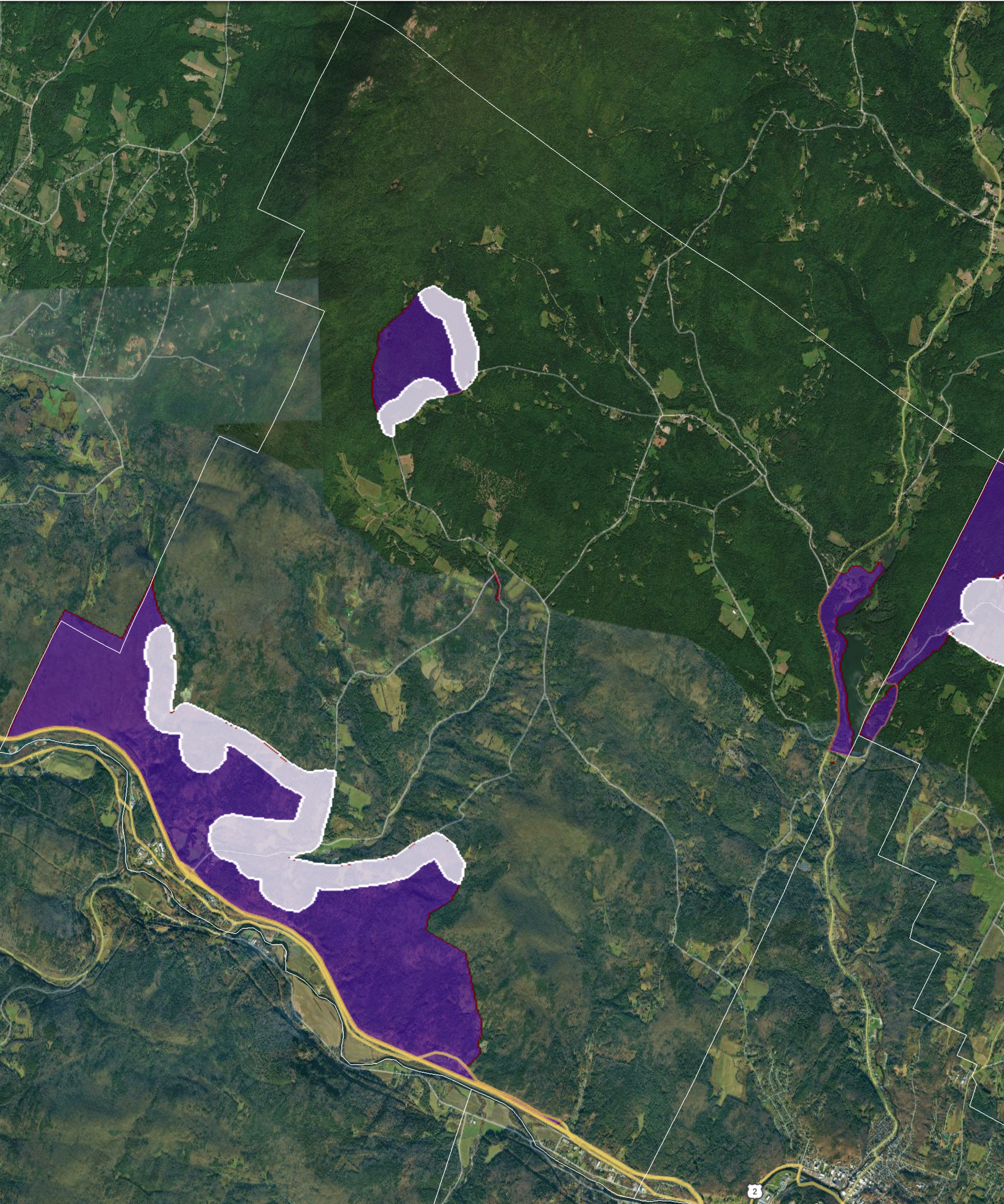
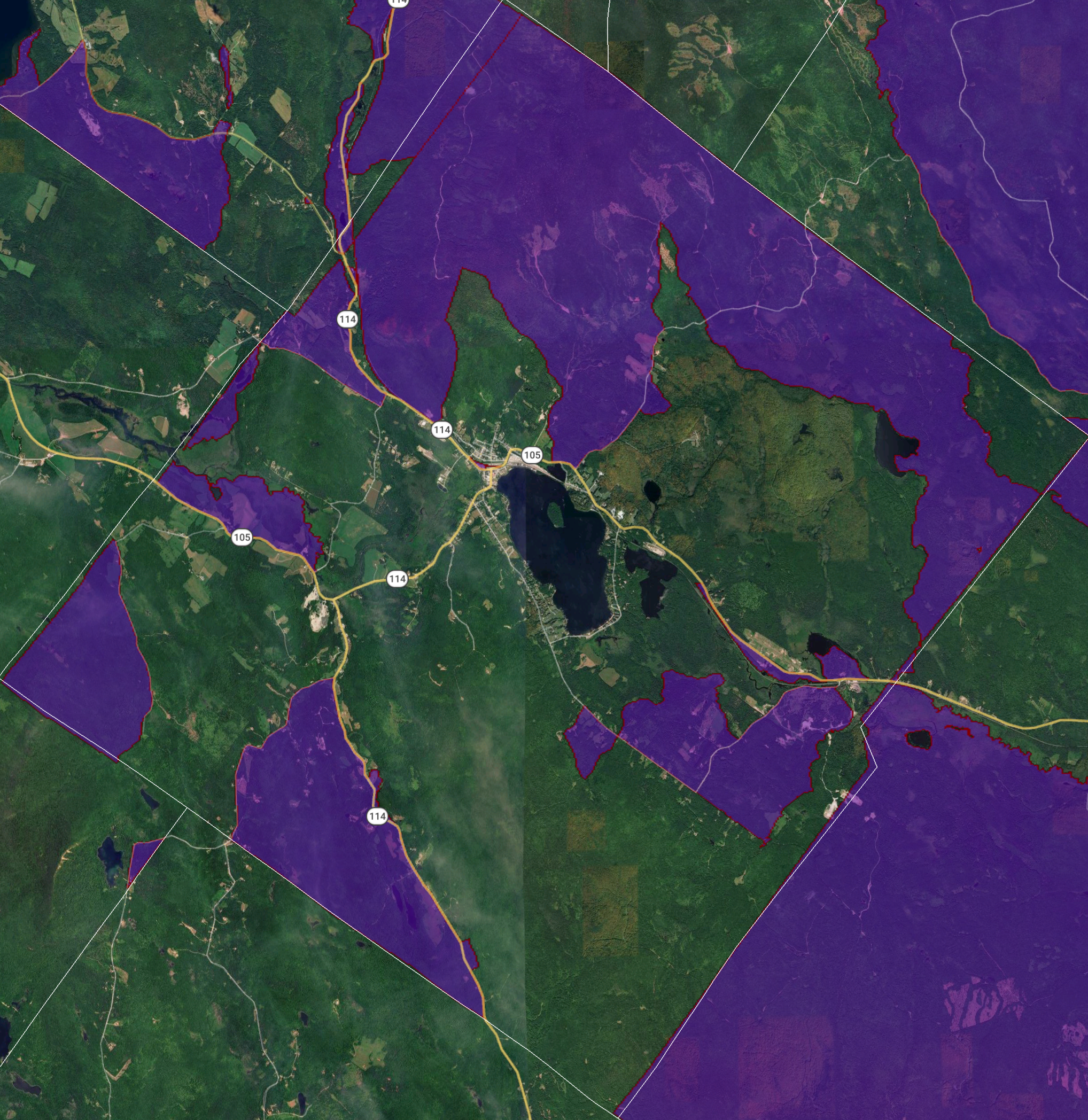
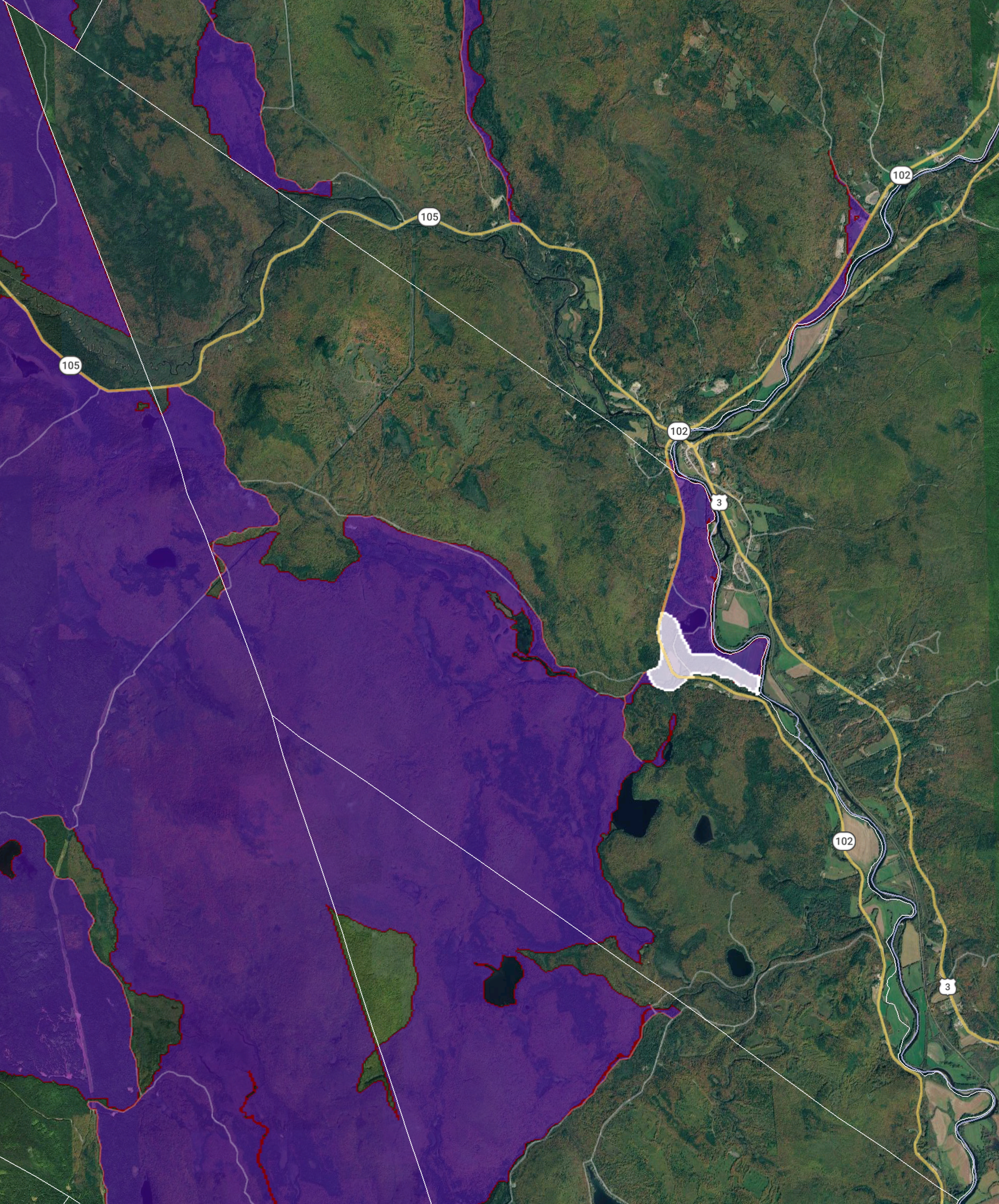
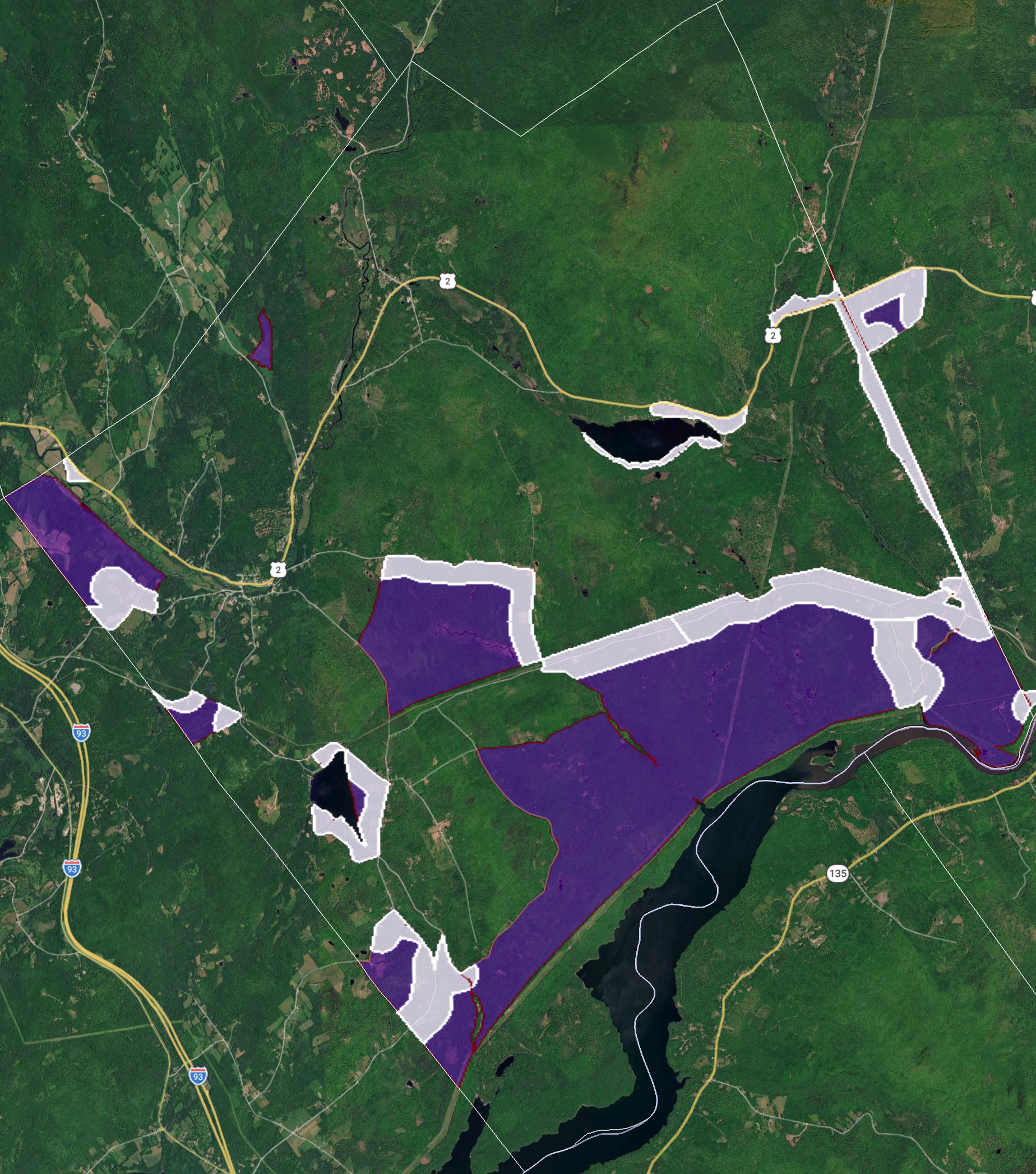
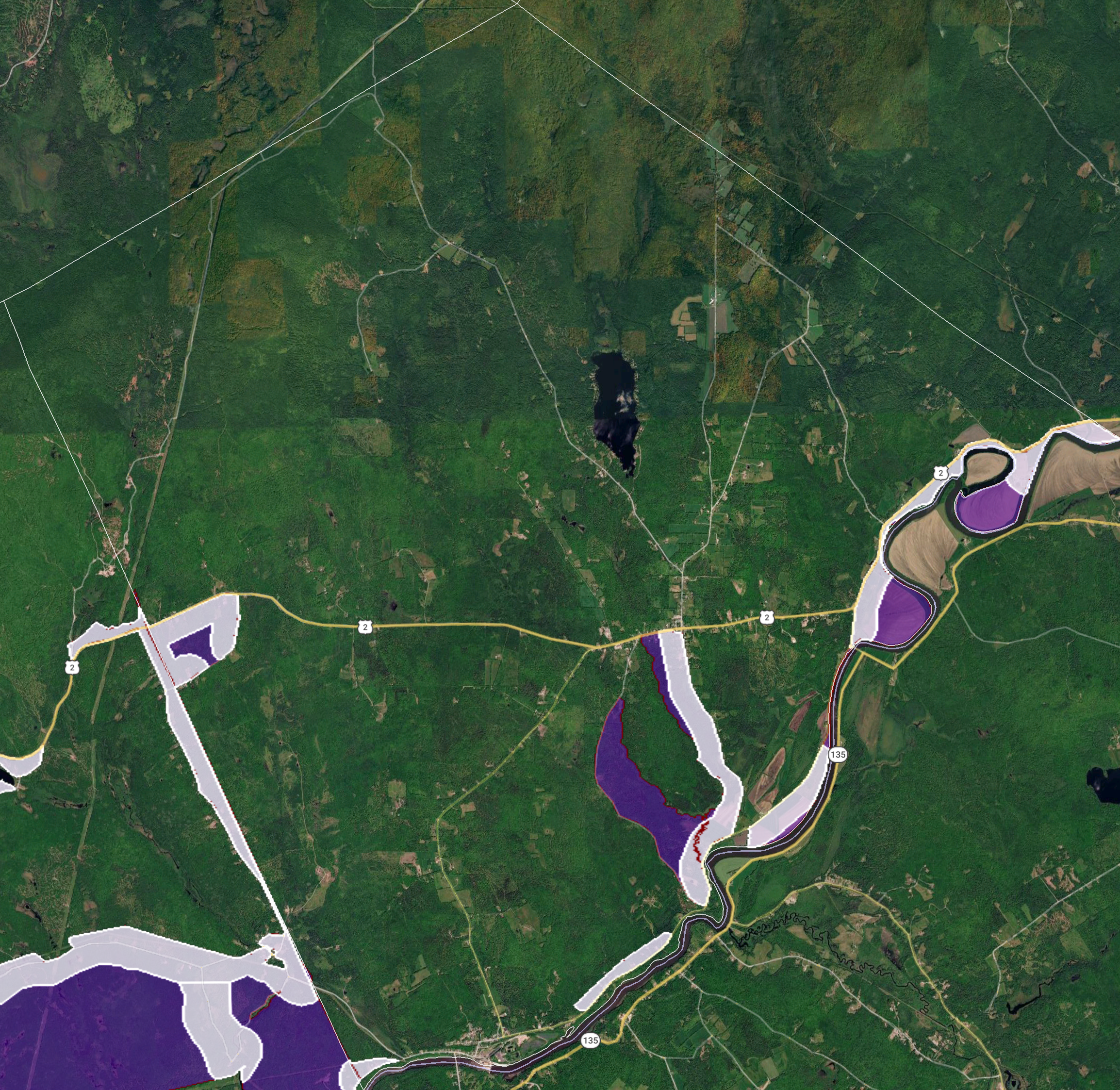
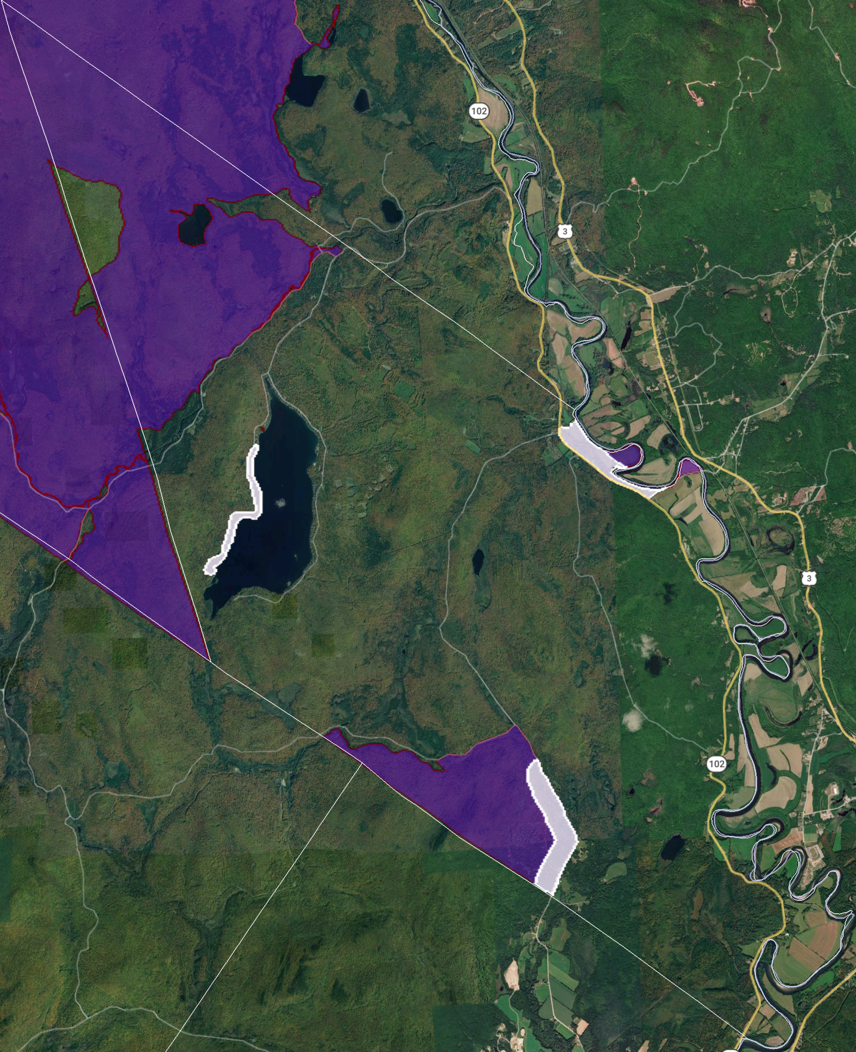
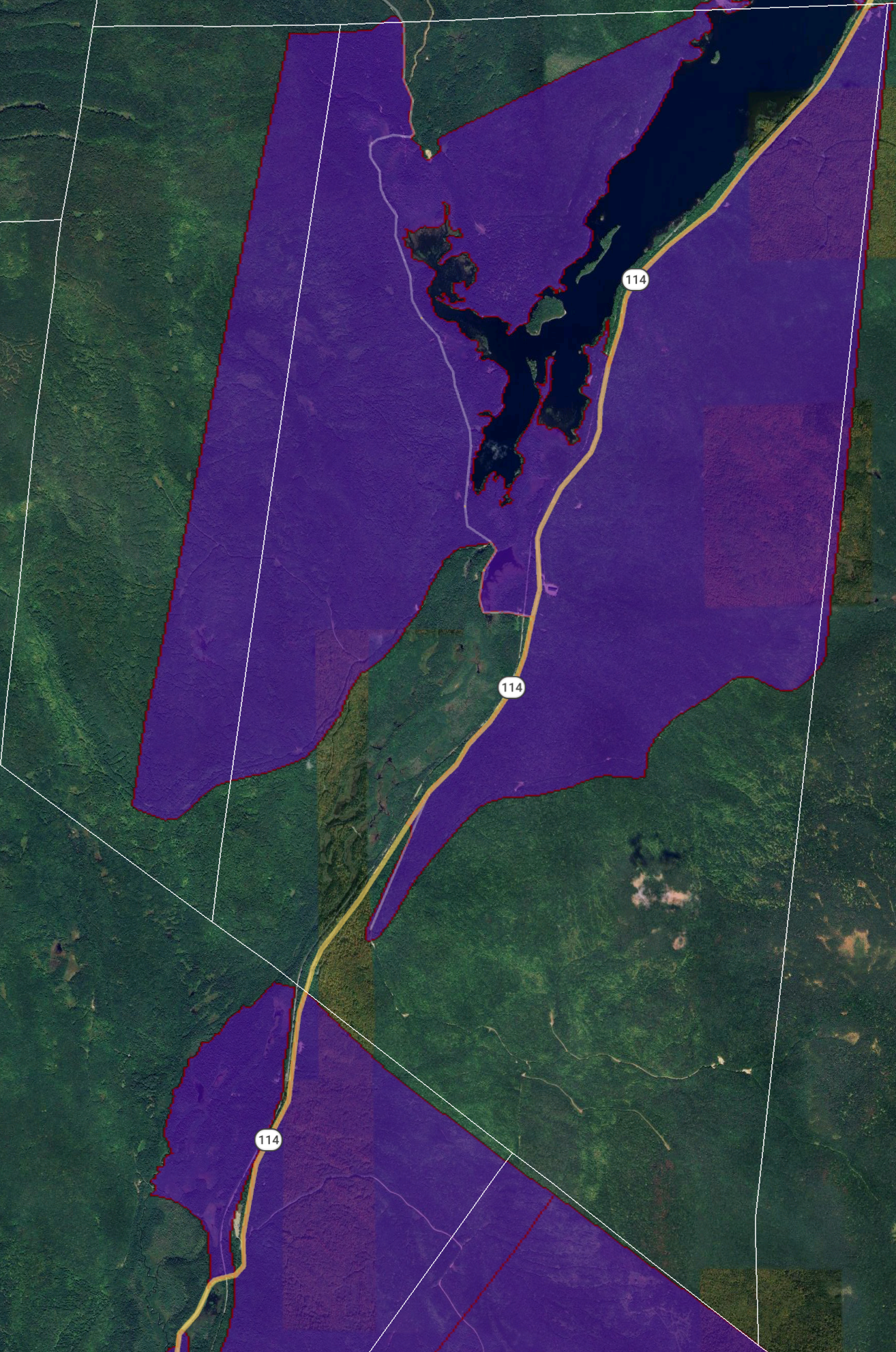
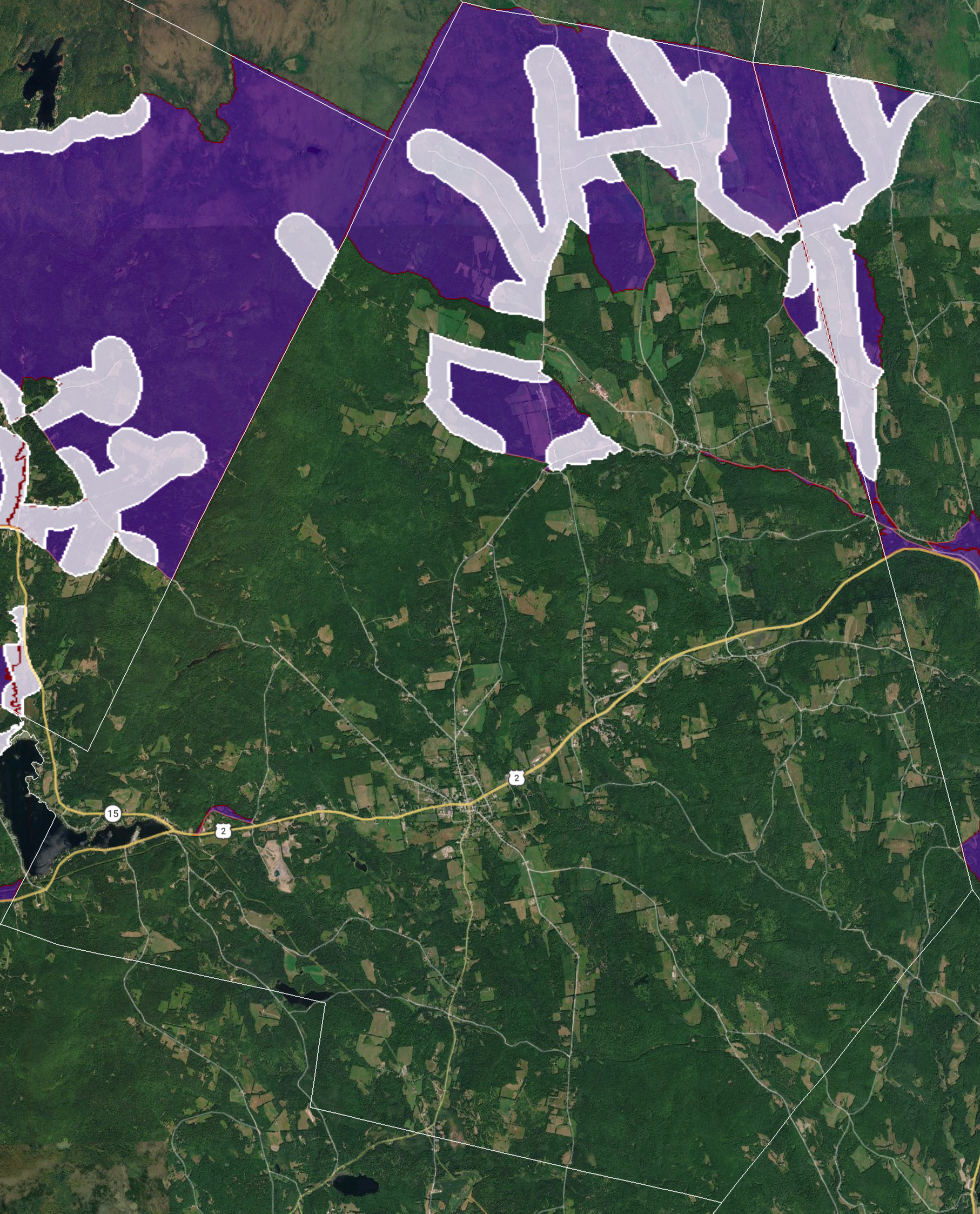
Are we now able to serve you? Will we be? Check out these Route Maps.
maps on this page
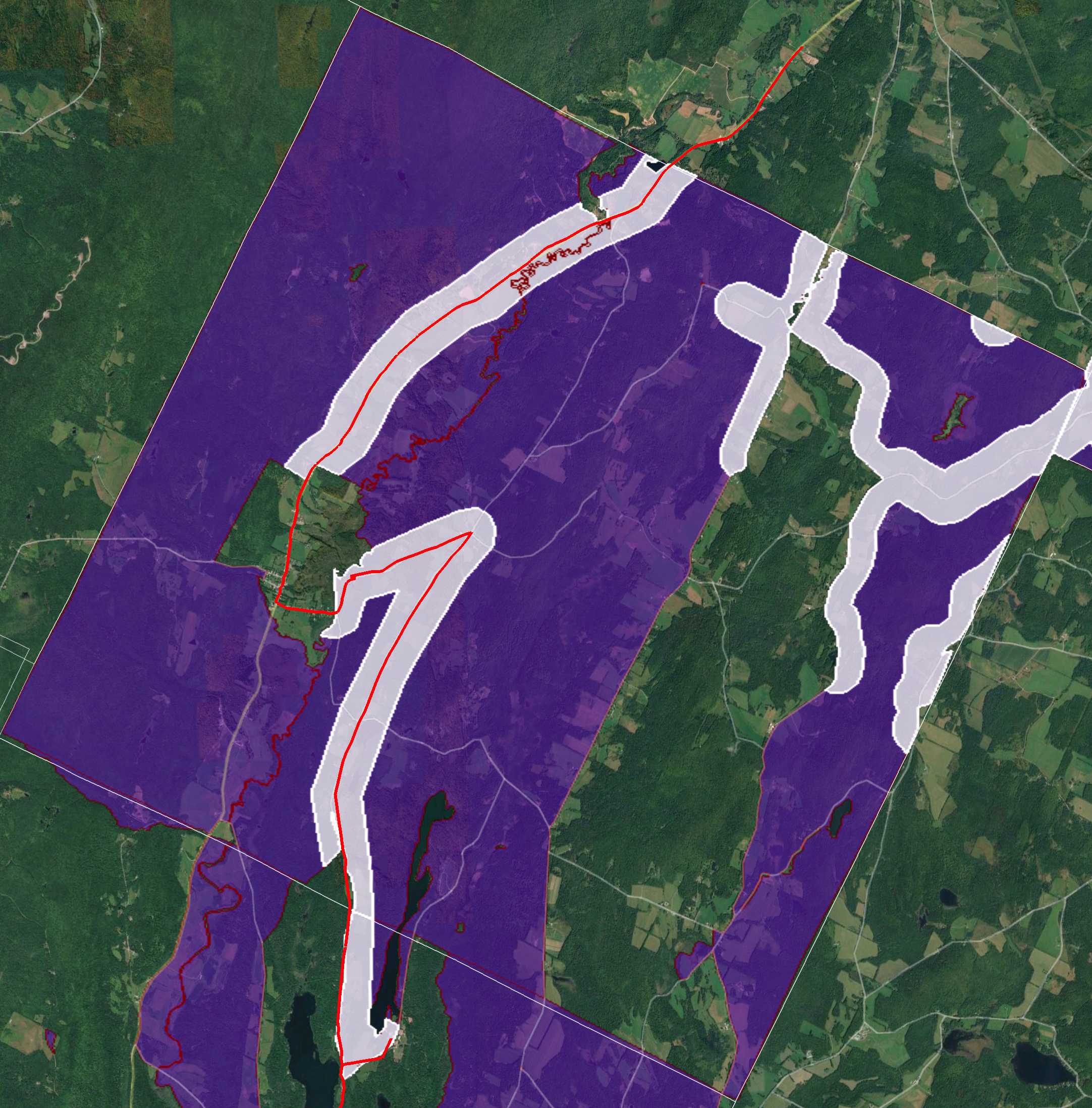
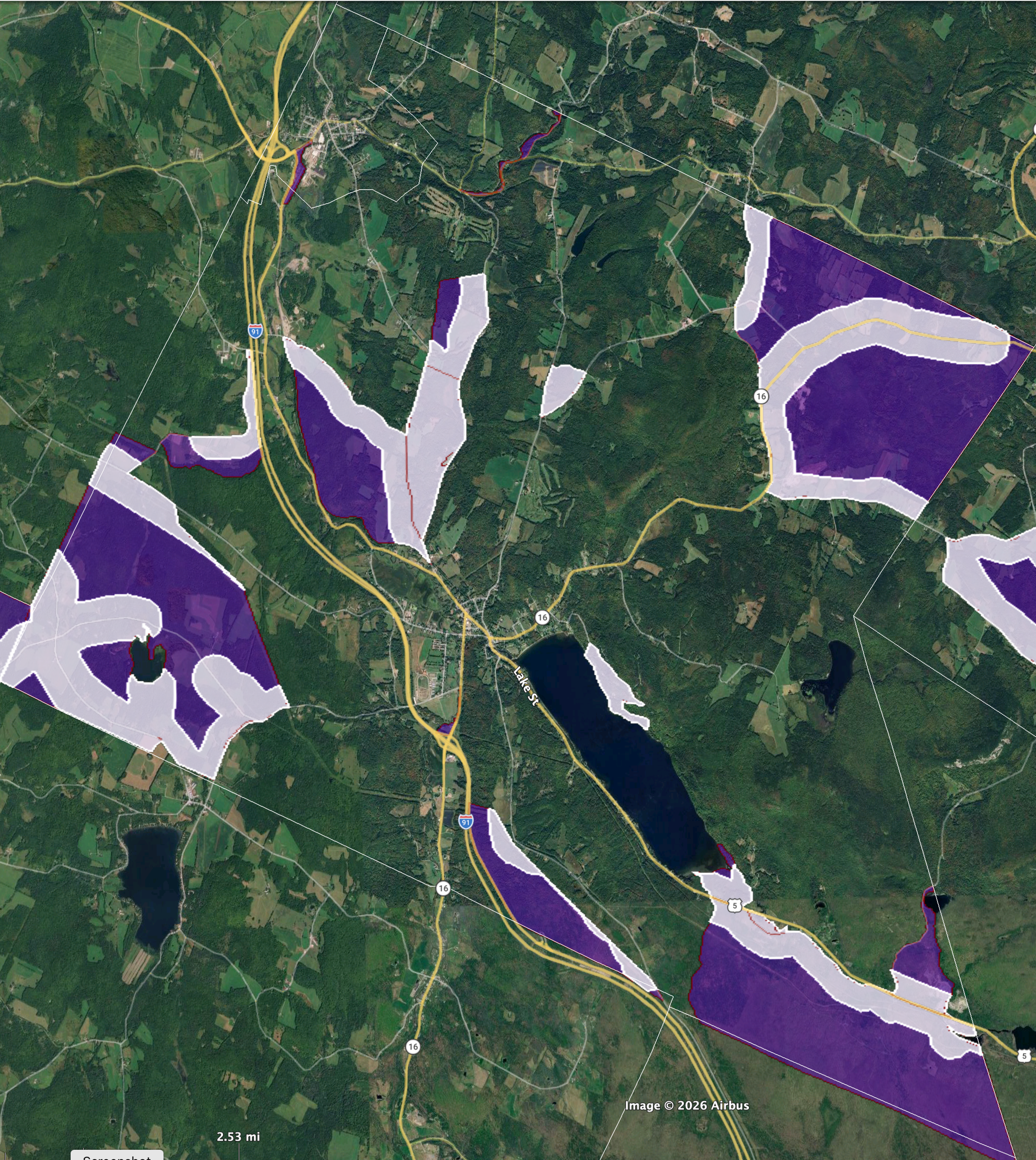
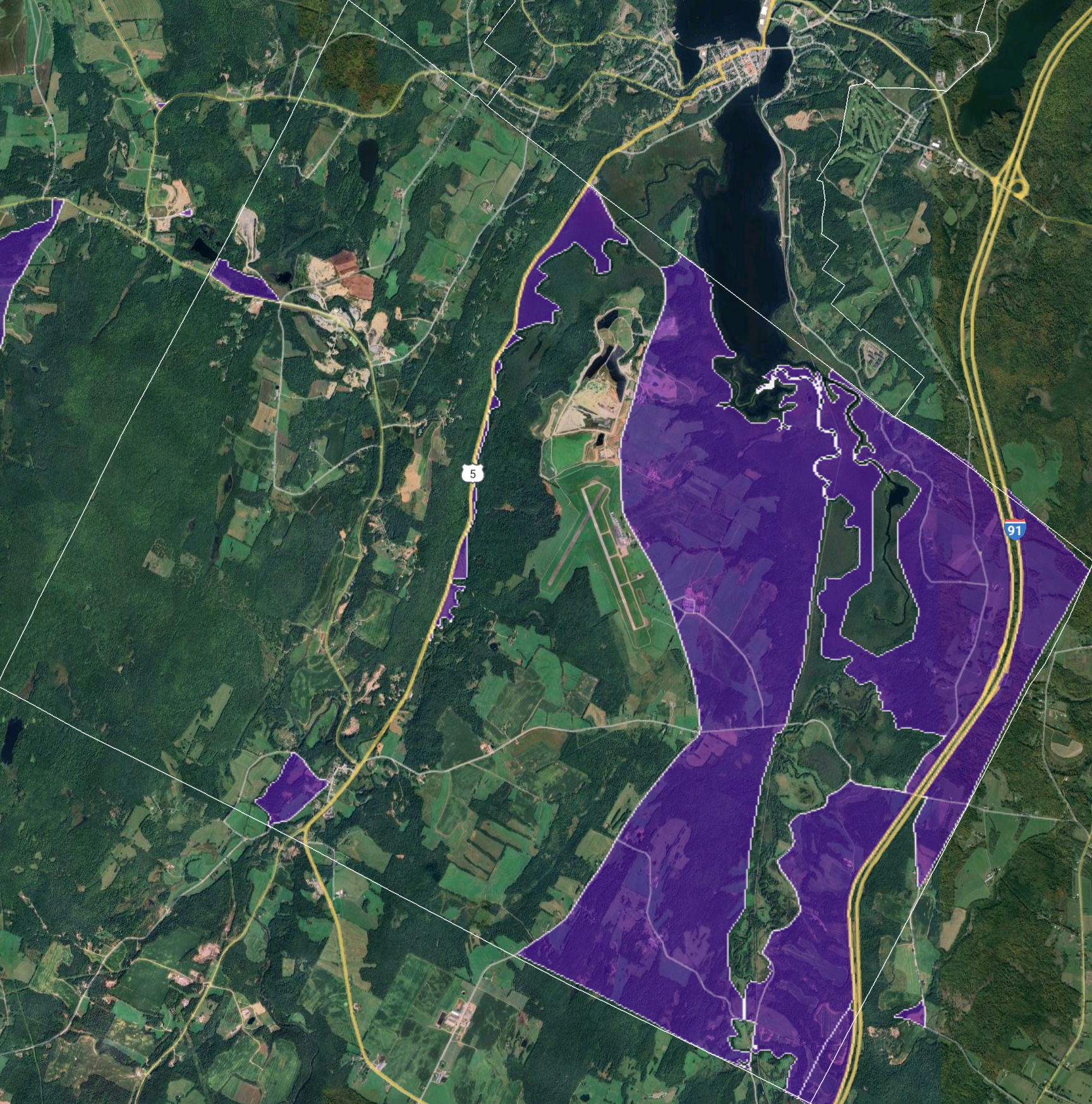
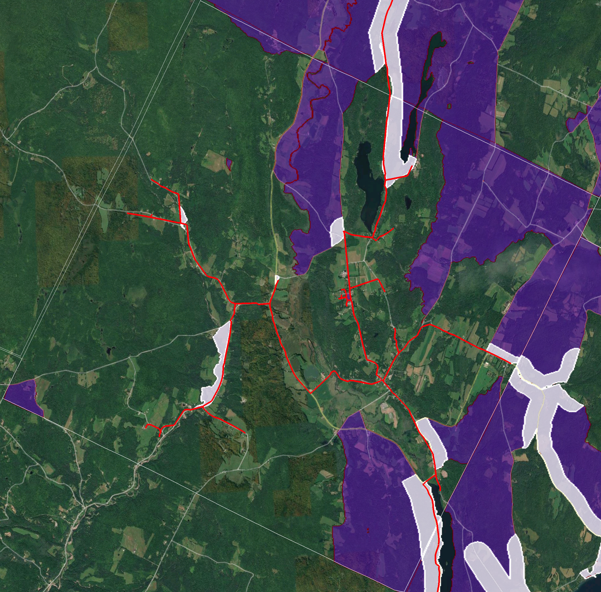
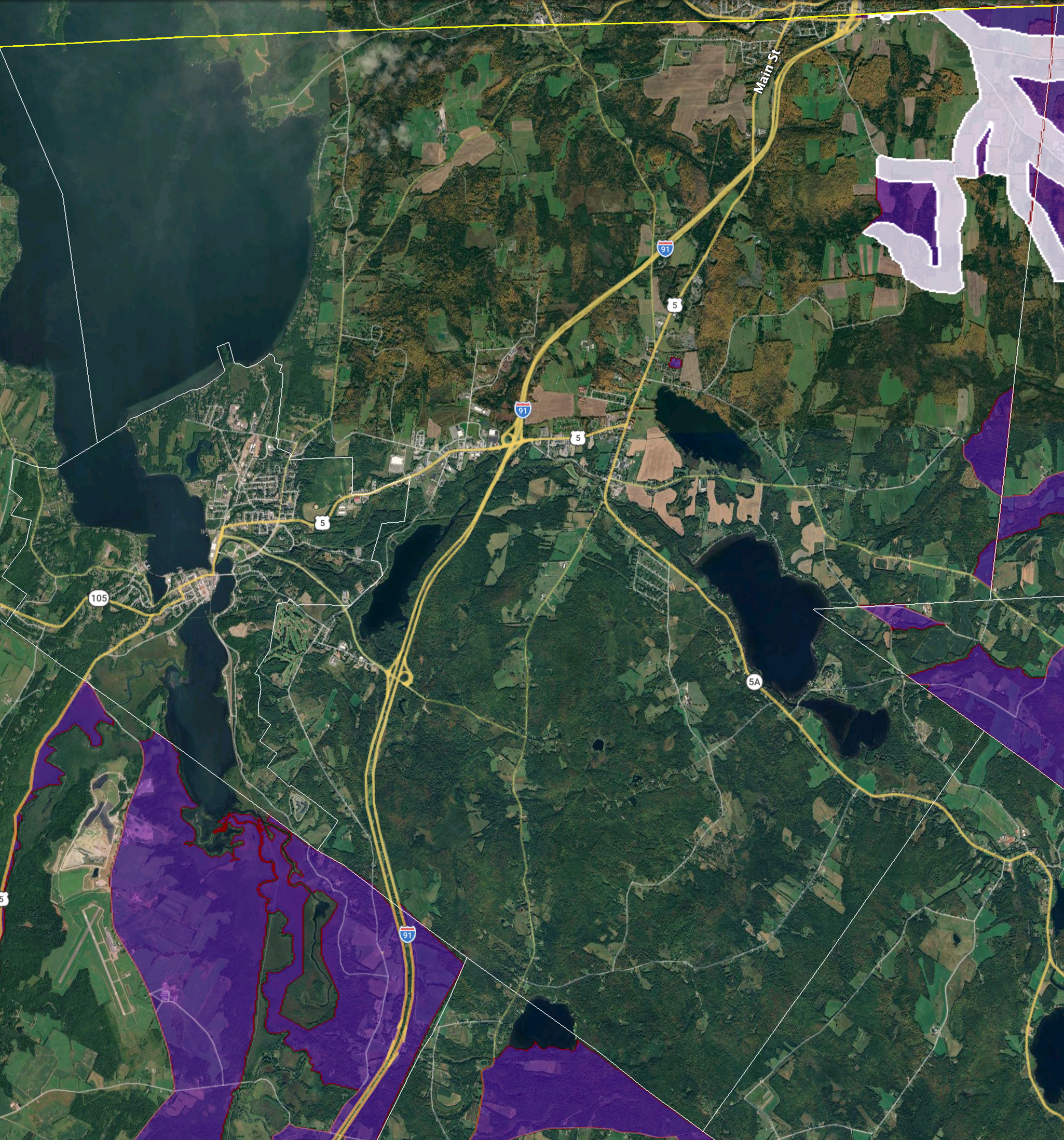
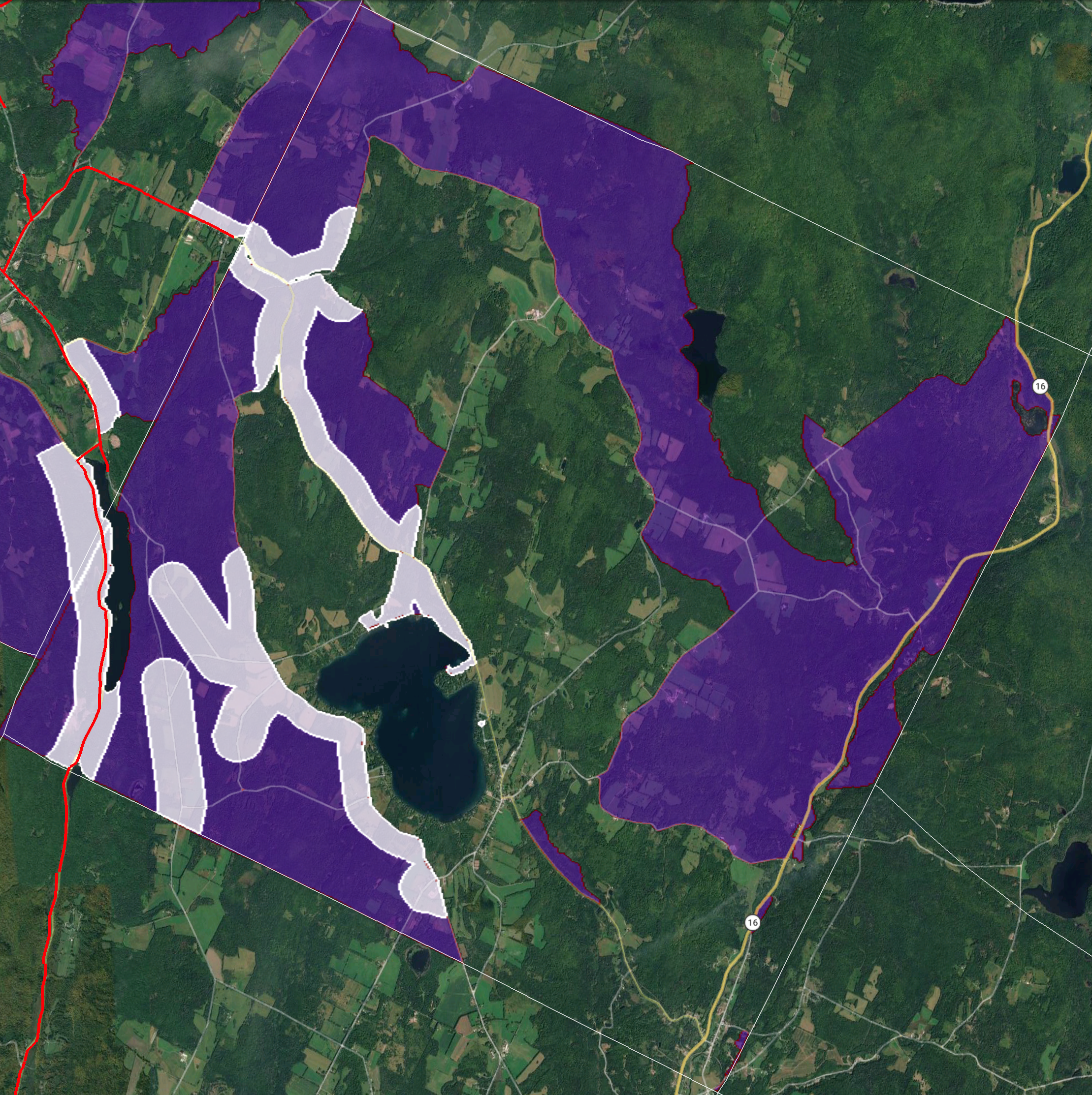
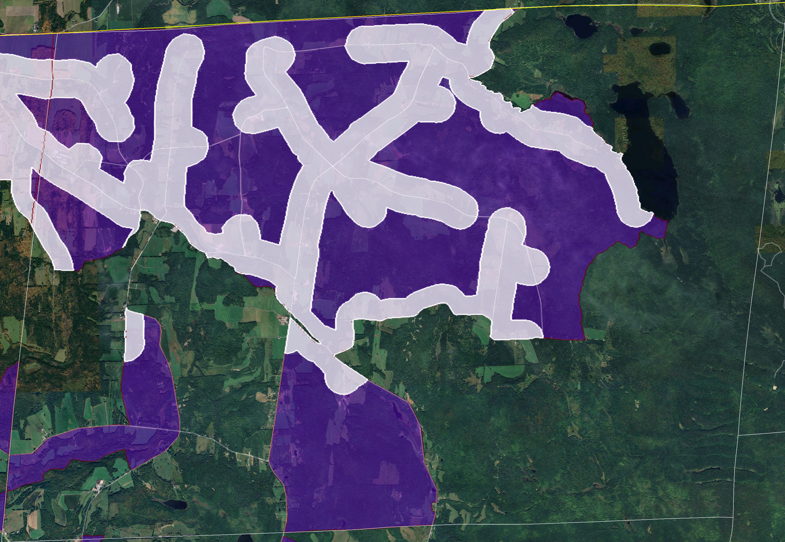
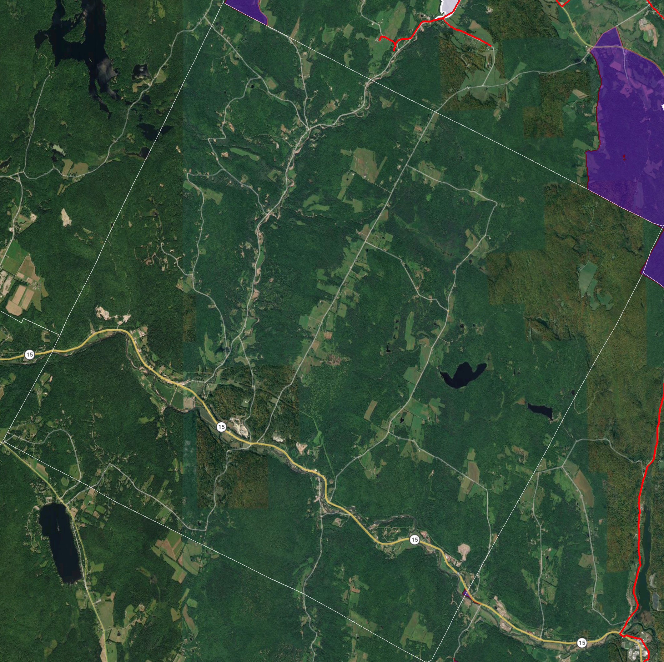
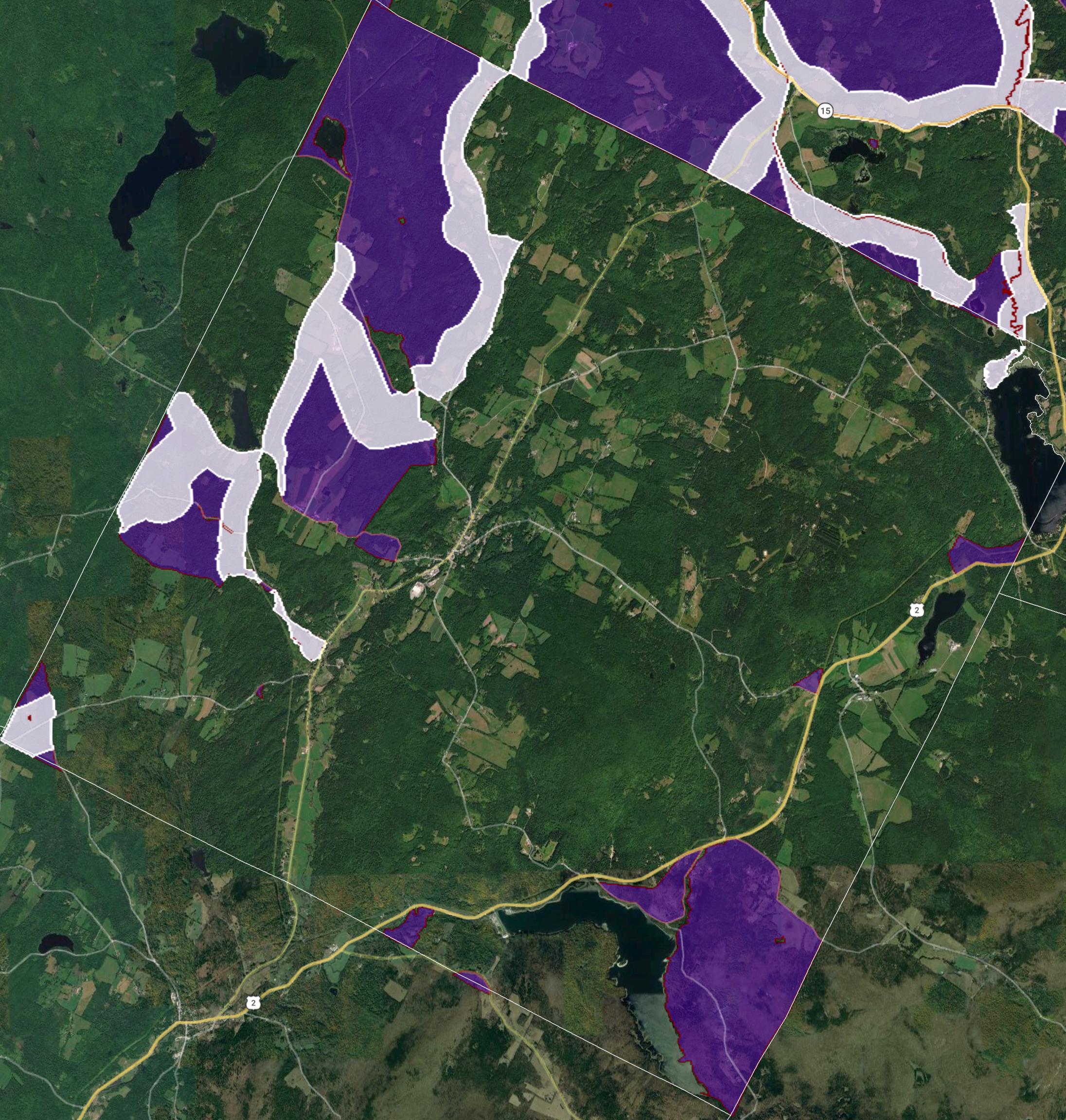
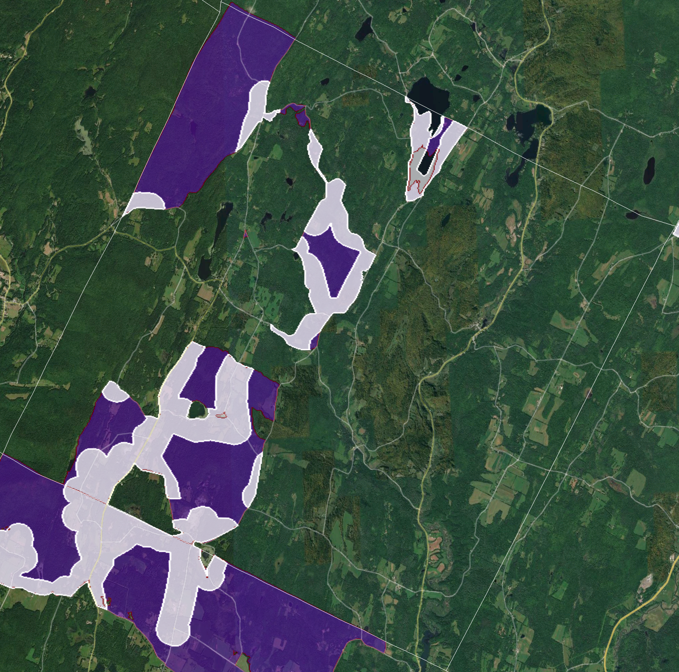
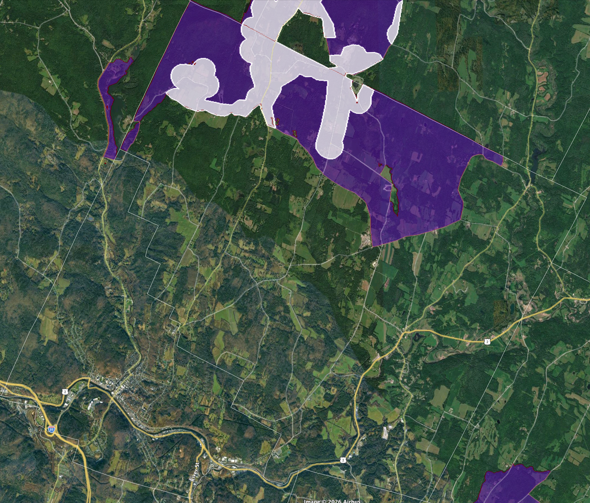
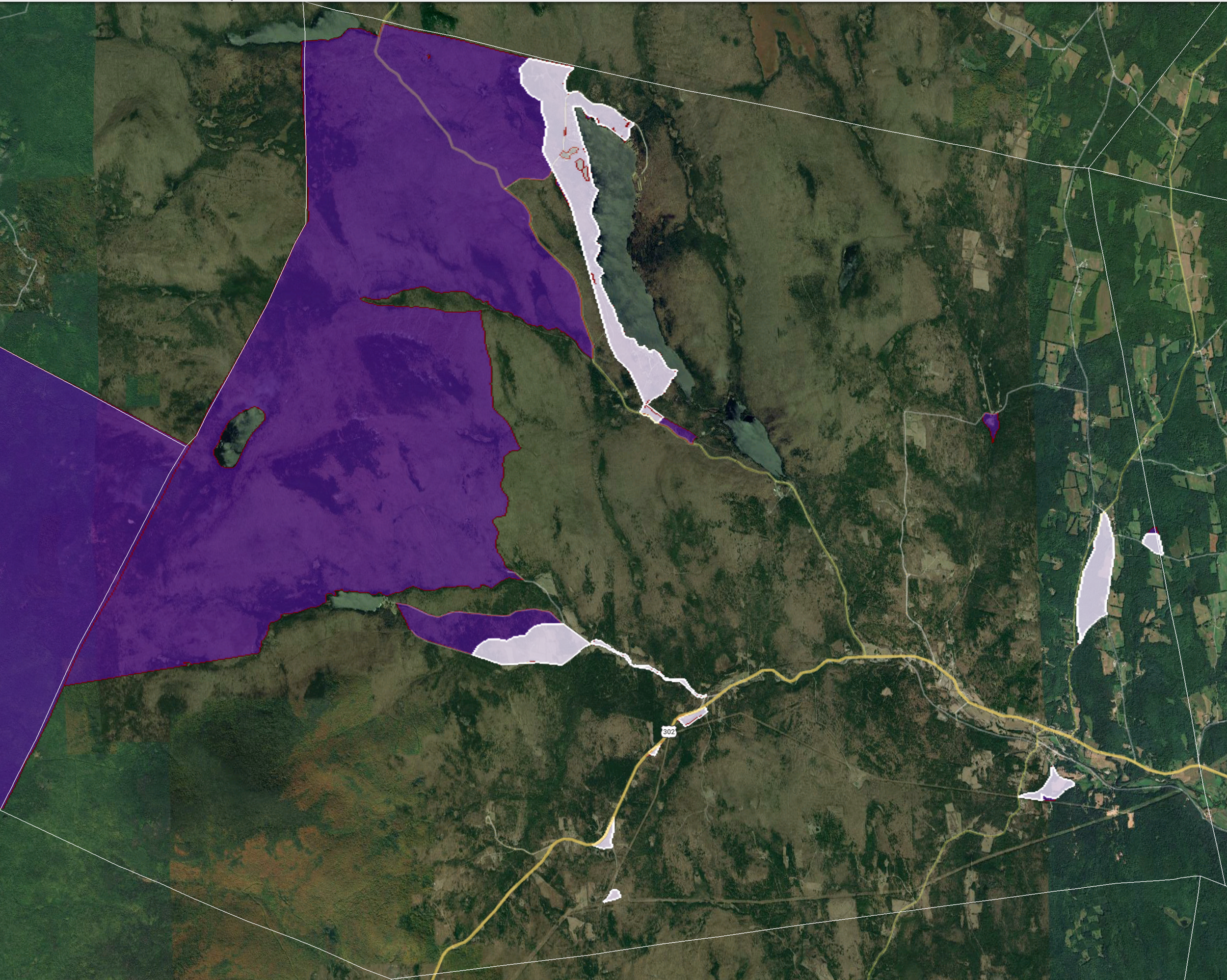
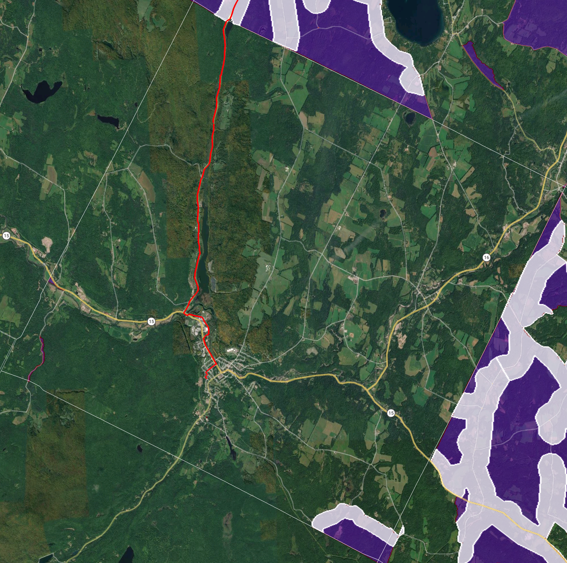
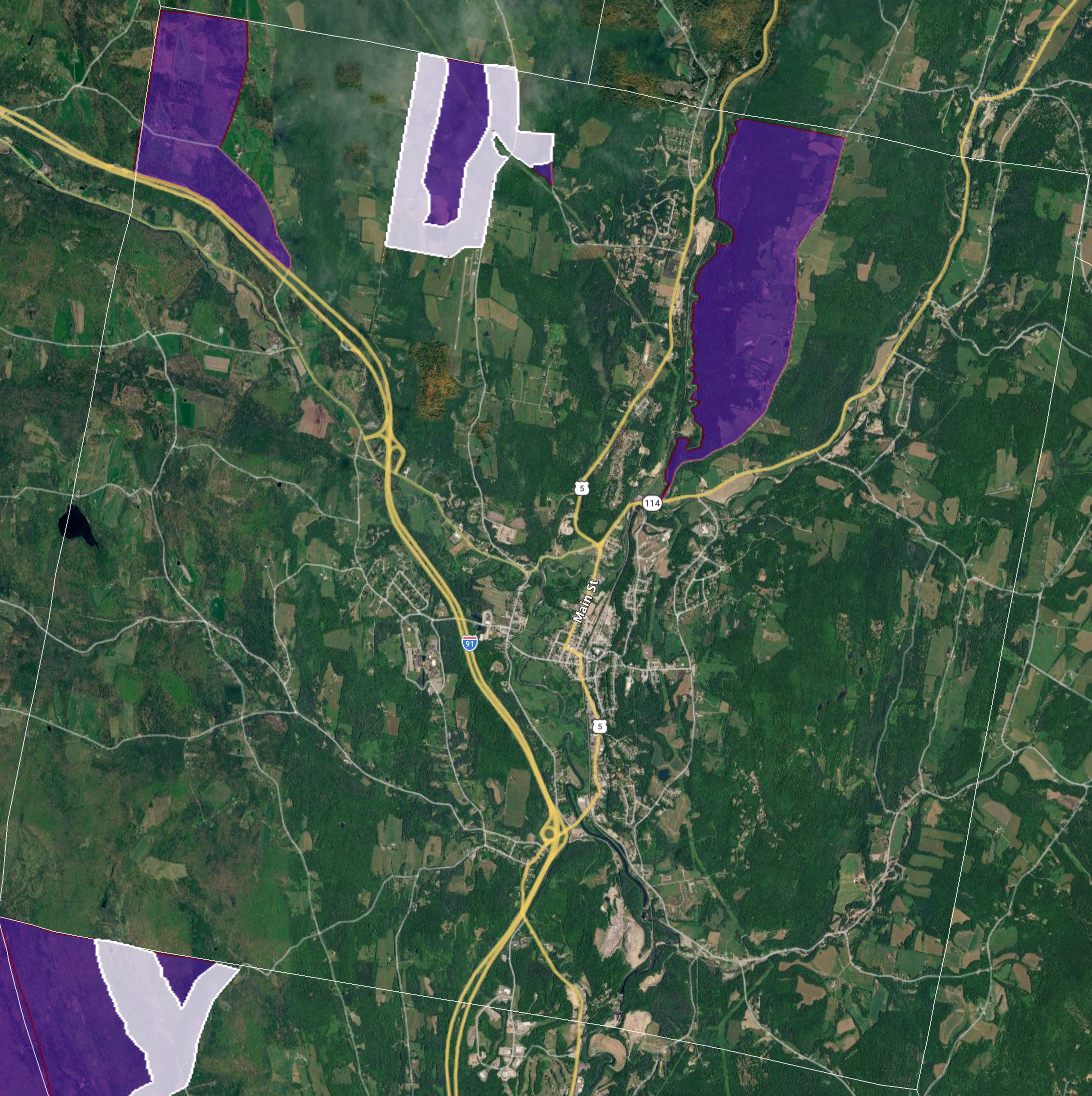
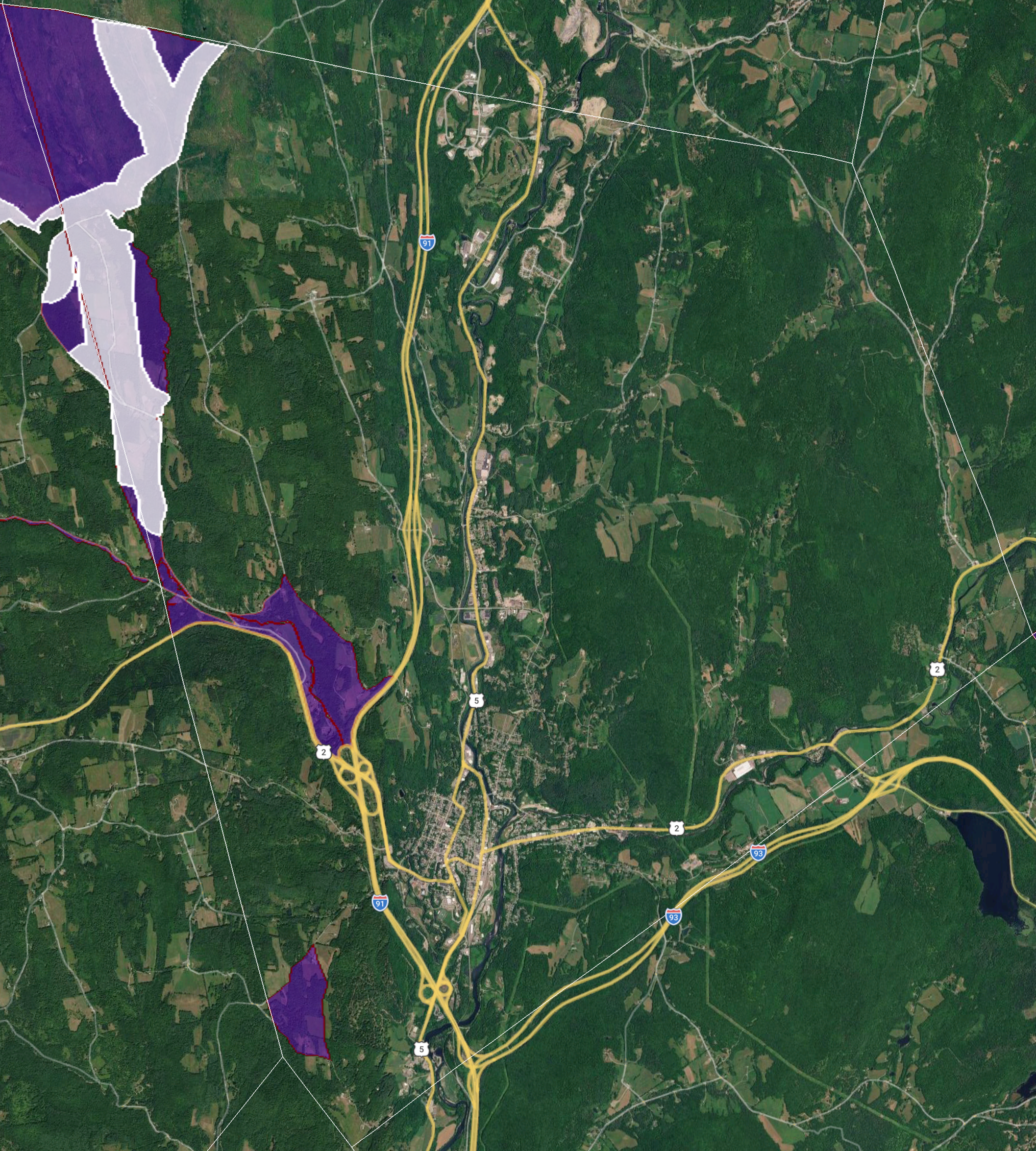
Please note that the Google Earth images, below, are dense files and may take a good while to load with slower internet service. They show an overview, all the towns we serve now, and the ones in our future. The towns are grouped by county and arranged within the groups in alphabetical order (matching the order on the ALL TOWNS page). Our networks continue to expand within our already served towns and to unserved ones. Check back here occasionally to see our progress.
legend
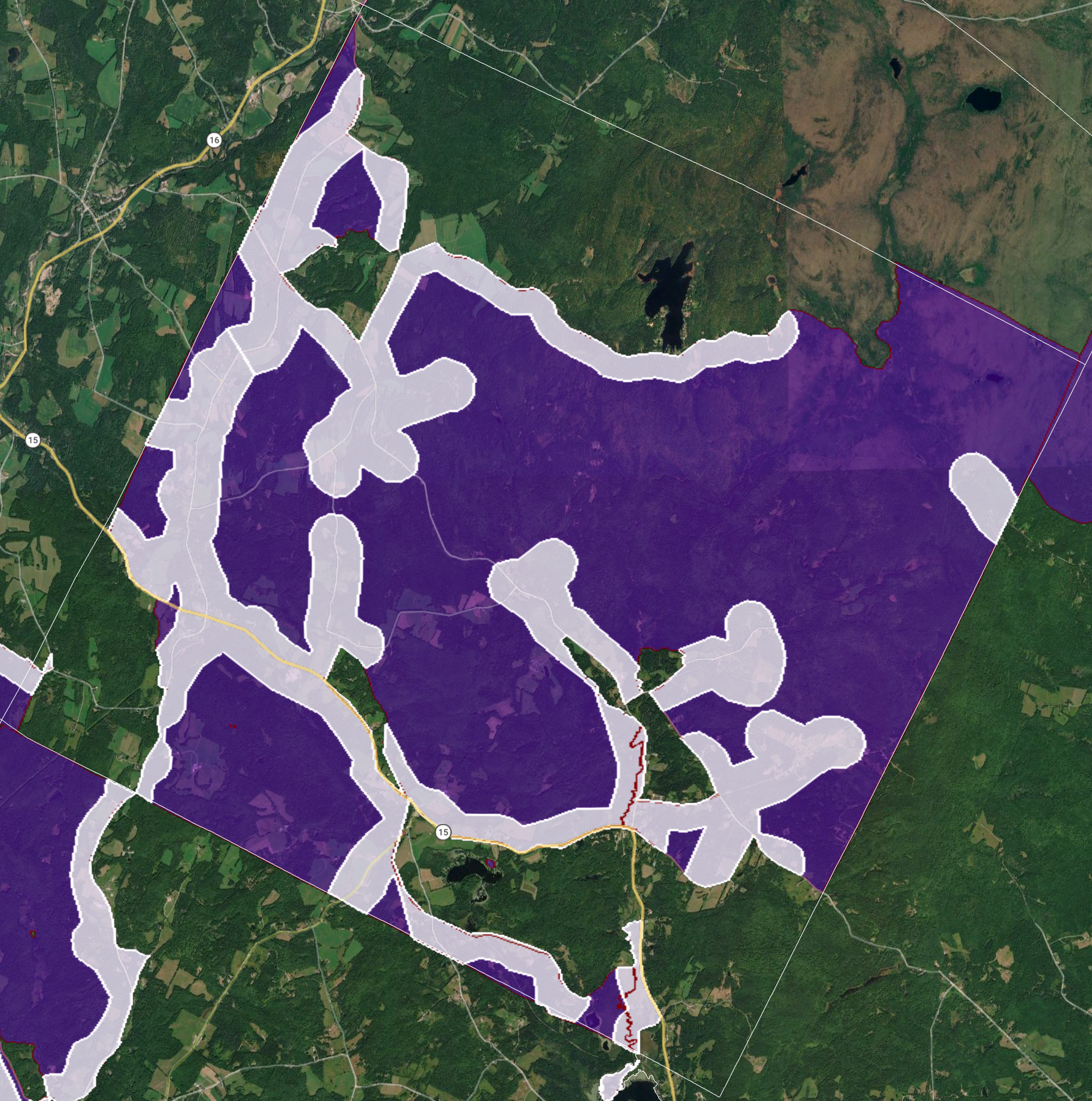
Red lines: These lines represent already-constructed fiber routes in our “Original Networks,” where we can usually serve locations within an approximately 1,000-foot buffer area.
Purple polygons: Construction to serve locations in these zones is partially funded by support from the FCC’s Rural Digital Opportunity Fund (RDOF). We expect to offer service to virtually every location within reach of utility lines in these zones by end of 2028.
White polygons: These highlight corridors that we already serve within the purple RDOF zones.
we’ll serve or refer
Is your location away from the red routes and outside of the white RDOF zones? If it’s in Craftsbury or Albany or just over those town borders in Wolcott, Greensboro, or Lowell, we’ll get to you in late 2026. If it’s in a purple RDOF zone, we’re still planning to serve you. And, if we can’t serve you, our active collaboration with NEK-CV Broadband means that you won’t be left behind. We’ll be pleased to refer your interest to them. Alternatively, if there’s no fiber internet available at your location, we may refer you to Cloud Alliance, NEW Alliance, or New England Wireless — our allied fixed-wireless providers.
updating the maps
Our service is now available in portions of 22 of our 38 projected towns (includes two gores). As we expand route construction, we will periodically update the maps.
Most recent update: 8/1/26.